 providing INFORMATION
  Well-Being Indicators
 Profiles
 Tables and Charts
 Map Centre
Well-Being Indicator Summary Table
Well-Being Summary Table for Census Subdivisions in Ontario
This table gives you a summary of the rankings of Census Subdivisions on each indicator, and then provides an overall composite score for each Census Subdivision. Please note this list is not complete and more indicators will be added as information becomes available.
 Geography |
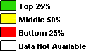
Employment Rate 2016 | 2016 Median Individual After-tax Income 2016 | Reds | Greens | Overall Score |
|
Geography |
Employment Rate 2016 | 2016 Median Individual After-tax Income 2016 | Reds | Greens | Overall Score |
|---|---|---|---|---|---|
| Thunder Bay | 56 | 32400 | 0 | 2 | 2 |
| Oliver Paipoonge | 63.8 | 38310 | 0 | 2 | 2 |
| Gillies | 64.3 | 30336 | 0 | 1 | 1 |
| O'Connor | 59.3 | 38101 | 0 | 2 | 2 |
| Conmee | 64.1 | 36896 | 0 | 2 | 2 |
| Shuniah | 53.8 | 40306 | 0 | 1 | 1 |
| Dorion | 51 | 32544 | 0 | 1 | 1 |
| Red Rock | 45.3 | 33280 | 0 | 1 | 1 |
| Nipigon | 46.5 | 29104 | 0 | 0 | 0 |
| Schreiber | 54.7 | 33331 | 0 | 2 | 2 |
| Terrace Bay | 55.2 | 37248 | 0 | 2 | 2 |
| Marathon | 59.9 | 34320 | 0 | 2 | 2 |
| Pic Mobert North | 34.6 | 1 | 0 | -1 | |
| Pic River 50 | 49.2 | 24128 | 0 | 0 | 0 |
| Pays Plat 51 | 50 | 0 | 0 | 0 | |
| Lake Helen 53A | 48.9 | 22784 | 0 | 0 | 0 |
| Manitouwadge | 45 | 27760 | 0 | 0 | 0 |
| Ginoogaming First Nation | 34.5 | 1 | 0 | -1 | |
| Long Lake 58 | 26.9 | 13003 | 2 | 0 | -2 |
| Rocky Bay 1 | 43.3 | 0 | 0 | 0 | |
| Greenstone | 51.3 | 31808 | 0 | 0 | 0 |
| Aroland 83 | 41.7 | 13920 | 2 | 0 | -2 |
| Ojibway Nation of Saugeen (Savant Lake) | 54.5 | 0 | 1 | 1 | |
| Osnaburgh 63A | 33.3 | 1 | 0 | -1 | |
| Thunder Bay, Unorganized | 52.3 | 32531 | 0 | 1 | 1 |
| Atikokan | 48.7 | 30795 | 0 | 0 | 0 |
| Alberton | 66.9 | 39488 | 0 | 2 | 2 |
| Fort Frances | 56.9 | 32936 | 0 | 2 | 2 |
| La Vallee | 59.9 | 35456 | 0 | 2 | 2 |
| Emo | 58.4 | 33152 | 0 | 2 | 2 |
| Chapple | 63.3 | 30400 | 0 | 1 | 1 |
| Manitou Rapids 11 | 50 | 18400 | 1 | 0 | -1 |
| Morley | 62.2 | 27456 | 0 | 1 | 1 |
| Dawson | 60 | 27648 | 0 | 1 | 1 |
| Rainy River | 34.7 | 28147 | 1 | 0 | -1 |
| Lake of the Woods | 39.6 | 1 | 0 | -1 | |
| Big Grassy River 35G | 43.8 | 0 | 0 | 0 | |
| Saug-a-Gaw-Sing 1 | 62.5 | 0 | 1 | 1 | |
| Neguaguon Lake 25D | 44.4 | 0 | 0 | 0 | |
| Rainy Lake 18C | 43.8 | 0 | 0 | 0 | |
| Couchiching 16A | 49.6 | 20139 | 1 | 0 | -1 |
| Rainy Lake 26A | 56.5 | 0 | 1 | 1 | |
| Seine River 23A | 25 | 12448 | 2 | 0 | -2 |
| Rainy Lake 17A | 44.4 | 0 | 0 | 0 | |
| Rainy River, Unorganized | 51.5 | 36949 | 0 | 1 | 1 |
| Ignace | 48 | 28128 | 0 | 0 | 0 |
| Whitefish Bay 32A | 45.5 | 19861 | 1 | 0 | -1 |
| Whitefish Bay 33A | 38.5 | 1 | 0 | -1 | |
| Sioux Narrows - Nestor Falls | 49.5 | 31696 | 0 | 0 | 0 |
| Kenora | 60.7 | 35161 | 0 | 2 | 2 |
| Machin | 50.6 | 33280 | 0 | 1 | 1 |
| Eagle Lake 27 | 40.5 | 1 | 0 | -1 | |
| Dryden | 57 | 33516 | 0 | 2 | 2 |
| Ear Falls | 71.4 | 36352 | 0 | 2 | 2 |
| Sioux Lookout | 66.9 | 38757 | 0 | 2 | 2 |
| Red Lake | 69.1 | 42926 | 0 | 2 | 2 |
| Slate Falls | 41.7 | 1 | 0 | -1 | |
| Pickle Lake | 70.9 | 32320 | 0 | 2 | 2 |
| Fort Albany (Part) 67, Part 1 | 25.9 | 10848 | 2 | 0 | -2 |
| Attawapiskat 91A | 34.3 | 17792 | 2 | 0 | -2 |
| Marten Falls 65 | 40.6 | 14944 | 2 | 0 | -2 |
| Fort Hope 64 | 37.6 | 17552 | 2 | 0 | -2 |
| Cat Lake 63C | 24.3 | 15584 | 2 | 0 | -2 |
| Osnaburgh 63B | 30.2 | 15520 | 2 | 0 | -2 |
| Lac Seul 28 | 38.3 | 17675 | 2 | 0 | -2 |
| Wabigoon Lake 27 | 53.6 | 0 | 0 | 0 | |
| English River 21 | 37.8 | 9696 | 2 | 0 | -2 |
| Weagamow Lake 87 | 51.3 | 20800 | 1 | 0 | -1 |
| Wabaseemoong | 35.6 | 8232 | 2 | 0 | -2 |
| Sabaskong Bay 35D | 40 | 13344 | 2 | 0 | -2 |
| Shoal Lake 34B2 | 39.1 | 1 | 0 | -1 | |
| Lake Of The Woods 37 | 50 | 0 | 0 | 0 | |
| Kenora 38B | 46.7 | 16832 | 1 | 0 | -1 |
| Poplar Hill | 29.6 | 20544 | 2 | 0 | -2 |
| Shoal Lake (Part) 39A | 50.9 | 12080 | 1 | 0 | -1 |
| Rat Portage 38A | 33.3 | 1 | 0 | -1 | |
| Deer Lake | 34.3 | 17704 | 2 | 0 | -2 |
| Sandy Lake 88 | 37 | 14912 | 2 | 0 | -2 |
| Kitchenuhmaykoosib Aaki 84 (Big Trout Lake) | 32.1 | 14573 | 2 | 0 | -2 |
| Sachigo Lake 1 | 53.1 | 17856 | 1 | 0 | -1 |
| Fort Severn 89 | 43.1 | 19904 | 1 | 0 | -1 |
| Webequie | 38.6 | 17664 | 2 | 0 | -2 |
| North Spirit Lake | 41 | 14848 | 2 | 0 | -2 |
| Shoal Lake (Part) 40 | 50 | 0 | 0 | 0 | |
| Whitefish Bay 34A | 43.8 | 0 | 0 | 0 | |
| Wabauskang 21 | 54.5 | 0 | 1 | 1 | |
| Wunnumin 1 | 40.3 | 15488 | 2 | 0 | -2 |
| Summer Beaver | 48 | 15840 | 1 | 0 | -1 |
| Wapekeka 2 | 46.2 | 19456 | 1 | 0 | -1 |
| The Dalles 38C | 46.2 | 0 | 0 | 0 | |
| Kenora, Unorganized | 52.4 | 34797 | 0 | 1 | 1 |
| Peawanuck | 41.4 | 1 | 0 | -1 | |
| Neskantaga | 42.4 | 0 | 0 | 0 | |
| Bearskin Lake | 54 | 17920 | 1 | 0 | -1 |
| Kasabonika Lake | 31.5 | 17248 | 2 | 0 | -2 |
| Muskrat Dam Lake | 59.5 | 20715 | 1 | 1 | 0 |
| Kingfisher Lake 1 | 52.9 | 25392 | 0 | 0 | 0 |
| Kee-Way-Win | 44.2 | 17744 | 1 | 0 | -1 |
| South Algonquin | 44.8 | 26304 | 0 | 0 | 0 |
| Papineau-Cameron | 48.6 | 25344 | 0 | 0 | 0 |
| Mattawan | 50 | 0 | 0 | 0 | |
| Mattawa | 39.9 | 23117 | 1 | 0 | -1 |
| Calvin | 30.7 | 21696 | 2 | 0 | -2 |
| Bonfield | 54.5 | 28800 | 0 | 1 | 1 |
| Chisholm | 54.6 | 26624 | 0 | 1 | 1 |
| East Ferris | 61.6 | 37632 | 0 | 2 | 2 |
| North Bay | 54 | 29586 | 0 | 0 | 0 |
| West Nipissing / Nipissing Ouest | 46.4 | 28129 | 0 | 0 | 0 |
| Temagami | 36.1 | 24107 | 1 | 0 | -1 |
| Nipissing 10 | 49.4 | 26016 | 0 | 0 | 0 |
| Nipissing, Unorganized, South Part | 46.7 | 0 | 0 | 0 | |
| Nipissing, Unorganized, North Part | 50.3 | 27712 | 0 | 0 | 0 |
| Seguin | 54.9 | 30775 | 0 | 1 | 1 |
| The Archipelago | 46.3 | 32256 | 0 | 1 | 1 |
| McMurrich/Monteith | 41.2 | 24768 | 1 | 0 | -1 |
| Perry | 53.4 | 26432 | 0 | 0 | 0 |
| Kearney | 45.1 | 26624 | 0 | 0 | 0 |
| Armour | 45.3 | 25963 | 0 | 0 | 0 |
| Burk's Falls | 41.5 | 22336 | 2 | 0 | -2 |
| Ryerson | 50 | 25152 | 0 | 0 | 0 |
| McKellar | 46 | 29952 | 0 | 0 | 0 |
| McDougall | 57.2 | 34078 | 0 | 2 | 2 |
| Parry Sound | 54.5 | 26901 | 0 | 1 | 1 |
| Carling | 52.8 | 32224 | 0 | 0 | 0 |
| Whitestone | 40.1 | 26219 | 1 | 0 | -1 |
| Magnetawan | 44 | 23456 | 0 | 0 | 0 |
| Strong | 47.1 | 26688 | 0 | 0 | 0 |
| Sundridge | 39.1 | 26773 | 1 | 0 | -1 |
| Joly | 42.6 | 22912 | 0 | 0 | 0 |
| Machar | 37.8 | 28096 | 1 | 0 | -1 |
| South River | 42.5 | 21099 | 1 | 0 | -1 |
| Powassan | 53.2 | 29816 | 0 | 0 | 0 |
| Callander | 61.1 | 36389 | 0 | 2 | 2 |
| Nipissing | 46.4 | 29536 | 0 | 0 | 0 |
| Shawanaga 17 | 45.2 | 0 | 0 | 0 | |
| Parry Island First Nation | 50 | 23936 | 0 | 0 | 0 |
| French River 13 | 36.8 | 1 | 0 | -1 | |
| Dokis 9 | 41.7 | 23040 | 1 | 0 | -1 |
| Magnetewan 1 | 42.9 | 0 | 0 | 0 | |
| Parry Sound, Unorganized, North East Part | 60 | 0 | 1 | 1 | |
| Parry Sound, Unorganized, Centre Part | 32.5 | 23056 | 1 | 0 | -1 |
| Tehkummah | 43 | 26133 | 0 | 0 | 0 |
| Central Manitoulin | 49.7 | 27861 | 0 | 0 | 0 |
| Assiginack | 54.8 | 29632 | 0 | 1 | 1 |
| Northeastern Manitoulin and the Islands | 47.5 | 28992 | 0 | 0 | 0 |
| Billings | 43.2 | 31040 | 0 | 0 | 0 |
| Gore Bay | 50 | 31008 | 0 | 0 | 0 |
| Gordon/Barrie Island | 43.2 | 27328 | 0 | 0 | 0 |
| Burpee and Mills | 40.3 | 26496 | 1 | 0 | -1 |
| Whitefish River (Part) 4 | 43.2 | 19878 | 1 | 0 | -1 |
| Sucker Creek 23 | 44.6 | 23067 | 0 | 0 | 0 |
| Sheguiandah 24 | 31.8 | 1 | 0 | -1 | |
| Wikwemikong Unceded | 38.4 | 17806 | 2 | 0 | -2 |
| Sheshegwaning 20 | 52.6 | 0 | 0 | 0 | |
| M'Chigeeng 22 (West Bay 22) | 46 | 18247 | 1 | 0 | -1 |
| Manitoulin, Unorganized, West Part | 21.7 | 1 | 0 | -1 | |
| Zhiibaahaasing 19A (Cockburn Island 19A) | 42.9 | 0 | 0 | 0 | |
| French River / Rivi�re des Fran�ais | 41.5 | 28663 | 1 | 0 | -1 |
| St.-Charles | 48.4 | 28160 | 0 | 0 | 0 |
| Markstay-Warren | 54.4 | 30704 | 0 | 0 | 0 |
| Sables-Spanish Rivers | 53.7 | 27179 | 0 | 0 | 0 |
| Espanola | 50.5 | 32619 | 0 | 1 | 1 |
| Baldwin | 51.9 | 29472 | 0 | 0 | 0 |
| Nairn and Hyman | 54.4 | 33792 | 0 | 1 | 1 |
| Killarney (2011 forward) | 45.8 | 28832 | 0 | 0 | 0 |
| Whitefish Lake 6 | 44.4 | 21888 | 1 | 0 | -1 |
| Mattagami 71 | 36.7 | 1 | 0 | -1 | |
| Duck Lake 76B | 41.7 | 1 | 0 | -1 | |
| Chapleau | 53.9 | 33429 | 0 | 1 | 1 |
| Sudbury, Unorganized, North Part | 47.2 | 32311 | 0 | 1 | 1 |
| Greater Sudbury / Grand Sudbury | 57.4 | 34149 | 0 | 2 | 2 |
| Wahnapitei 11 | 50 | 0 | 0 | 0 | |
| Coleman | 49.4 | 30144 | 0 | 0 | 0 |
| Latchford | 43.4 | 24640 | 0 | 0 | 0 |
| Cobalt | 42.1 | 21760 | 1 | 0 | -1 |
| Harris | 50.5 | 38400 | 0 | 1 | 1 |
| Temiskaming Shores | 55.3 | 29470 | 0 | 1 | 1 |
| Hudson | 63.4 | 35872 | 0 | 2 | 2 |
| Kerns | 72.9 | 24768 | 0 | 1 | 1 |
| Harley | 61.5 | 28704 | 0 | 1 | 1 |
| Casey | 69.6 | 32192 | 0 | 1 | 1 |
| Brethour | 71.4 | 0 | 1 | 1 | |
| Hilliard | 45.5 | 0 | 0 | 0 | |
| Armstrong | 60.6 | 29312 | 0 | 1 | 1 |
| Thornloe | 68.8 | 0 | 1 | 1 | |
| James | 47.4 | 28736 | 0 | 0 | 0 |
| Charlton and Dack | 44 | 26496 | 0 | 0 | 0 |
| Evanturel | 54.9 | 30976 | 0 | 1 | 1 |
| Englehart | 48.1 | 29589 | 0 | 0 | 0 |
| Chamberlain | 57.4 | 27008 | 0 | 1 | 1 |
| Matachewan | 38.7 | 1 | 0 | -1 | |
| Matachewan 72 | 70 | 0 | 1 | 1 | |
| McGarry | 42.2 | 23568 | 0 | 0 | 0 |
| Larder Lake | 50.4 | 30048 | 0 | 0 | 0 |
| Gauthier | 69.2 | 0 | 1 | 1 | |
| Kirkland Lake | 51.4 | 28708 | 0 | 0 | 0 |
| Timiskaming, Unorganized, West Part | 47.8 | 28896 | 0 | 0 | 0 |
| Black River-Matheson | 46.7 | 29003 | 0 | 0 | 0 |
| Timmins | 60.2 | 32944 | 0 | 2 | 2 |
| Iroquois Falls | 44.3 | 32626 | 0 | 1 | 1 |
| Abitibi 70 | 54.5 | 0 | 1 | 1 | |
| Cochrane | 56.4 | 31324 | 0 | 1 | 1 |
| Smooth Rock Falls | 32.4 | 30106 | 1 | 0 | -1 |
| Fauquier-Strickland | 36.7 | 26944 | 1 | 0 | -1 |
| Moonbeam | 50 | 33323 | 0 | 1 | 1 |
| Kapuskasing | 51.3 | 30656 | 0 | 0 | 0 |
| Val Rita-Harty | 54.3 | 30443 | 0 | 0 | 0 |
| Opasatika | 44.7 | 0 | 0 | 0 | |
| Hearst | 58.4 | 33122 | 0 | 2 | 2 |
| Mattice-Val C�t� | 45.5 | 27520 | 0 | 0 | 0 |
| Cochrane, Unorganized, North Part | 57.8 | 35872 | 0 | 2 | 2 |
| Fort Albany (Part) 67, Part 2 | 50 | 17280 | 1 | 0 | -1 |
| Factory Island 1 | 43.1 | 19797 | 1 | 0 | -1 |
| Constance Lake 92 | 33.3 | 18112 | 2 | 0 | -2 |
| New Post 69A | 57.1 | 0 | 1 | 1 | |
| Moosonee | 60.4 | 34304 | 0 | 2 | 2 |
| Jocelyn | 44.6 | 31552 | 0 | 0 | 0 |
| Hilton | 33.9 | 28480 | 1 | 0 | -1 |
| Hilton Beach | 42.9 | 0 | 0 | 0 | |
| St. Joseph | 45.8 | 32256 | 0 | 1 | 1 |
| Laird | 56.1 | 35840 | 0 | 2 | 2 |
| Tarbutt and Tarbutt Additional | 57 | 34688 | 0 | 2 | 2 |
| Johnson | 54.4 | 23328 | 0 | 0 | 0 |
| Plummer Additional | 56.6 | 24661 | 0 | 1 | 1 |
| Bruce Mines | 39.8 | 26283 | 1 | 0 | -1 |
| Thessalon 12 | 52.4 | 0 | 0 | 0 | |
| Thessalon | 46.2 | 28340 | 0 | 0 | 0 |
| Huron Shores | 40.3 | 25488 | 1 | 0 | -1 |
| Blind River | 46.3 | 27616 | 0 | 0 | 0 |
| Spanish | 33.6 | 22336 | 2 | 0 | -2 |
| North Shore | 38.5 | 26880 | 1 | 0 | -1 |
| Elliot Lake | 32.7 | 23770 | 1 | 0 | -1 |
| Macdonald, Meredith and Aberdeen Additional | 56.1 | 33481 | 0 | 2 | 2 |
| Sault Ste. Marie | 51.5 | 30374 | 0 | 0 | 0 |
| Prince | 51.4 | 36309 | 0 | 1 | 1 |
| Sagamok | 36 | 17760 | 2 | 0 | -2 |
| Serpent River 7 | 40.7 | 20032 | 2 | 0 | -2 |
| Mississagi River 8 | 54.7 | 22464 | 0 | 1 | 1 |
| Garden River 14 | 42.8 | 19200 | 1 | 0 | -1 |
| Wawa* | 58 | 32128 | 0 | 1 | 1 |
| Gros Cap 49 | 46.2 | 0 | 0 | 0 | |
| Dubreuilville | 59.8 | 33963 | 0 | 2 | 2 |
| White River | 59.8 | 34032 | 0 | 2 | 2 |
| Algoma, Unorganized, North Part | 50.2 | 29728 | 0 | 0 | 0 |
| Hornepayne | 56.9 | 43136 | 0 | 2 | 2 |
| Neebing | 55.5 | 37611 | 0 | 2 | 2 |
| Fort William 52 | 39.3 | 19168 | 2 | 0 | -2 |

* This area is combination of other areas. Scroll over the '*' to see the areas included.
Indicator Definitions
- Employment Rate: The rate of those who responded who were employed during the reference period.
- 2016 Median after-tax income among recipients: The median After-tax income of households in the geography.